BEGIN:VCALENDAR
VERSION:2.0
PRODID:-//ChamberMaster//Event Calendar 2.0//EN
METHOD:PUBLISH
X-PUBLISHED-TTL:P3D
REFRESH-INTERVAL:P3D
CALSCALE:GREGORIAN
BEGIN:VEVENT
DTSTART:20240319T121500Z
DTEND:20240319T133000Z
X-MICROSOFT-CDO-ALLDAYEVENT:FALSE
SUMMARY:Business & Government Forum: Planning Concepts to Build Pedestrian Connections and Housing Density
DESCRIPTION:Linking the Crown Hill\, lower Chandler\, Pleasant Street\, Elm Park\, and Highland Street and Salisbury Cultural District neighborhoods with downtown Worcester.\n\n\n\n\n\n\n\n\n\nA number of roads such as Lancaster Street\, also known as the West Side Artery\, were built in the 1950s as part of a growing movement in urban planning at the time to serve car access. This created virtual concrete canyons dividing various parts of the city. In particular\, the Crown Hill\, lower Chandler\, Pleasant Street\, Elm Park\, and Highland Street neighborhoods were effectively cut off from downtown. The Salisbury Cultural District and downtown were also impacted by the addition of streets such as Lancaster\, Harvard\, and Irving.\n\n \n\nTo address these past planning mistakes and encourage pedestrian connections\, add more community greenspaces\, and create housing density through infill development on excess surface parking lots in this area\, the Chamber has put together an urban planning concept paper for residents\, business and property owners\, and city officials to consider as future economic development and transportation planning priorities are considered.
X-ALT-DESC;FMTTYPE=text/html:
\nLinking the Crown Hill\, lower Chandler\, Pleasant Street\, Elm Park\, and Highland Street and Salisbury Cultural District neighborhoods with downtown Worcester.
\n
\n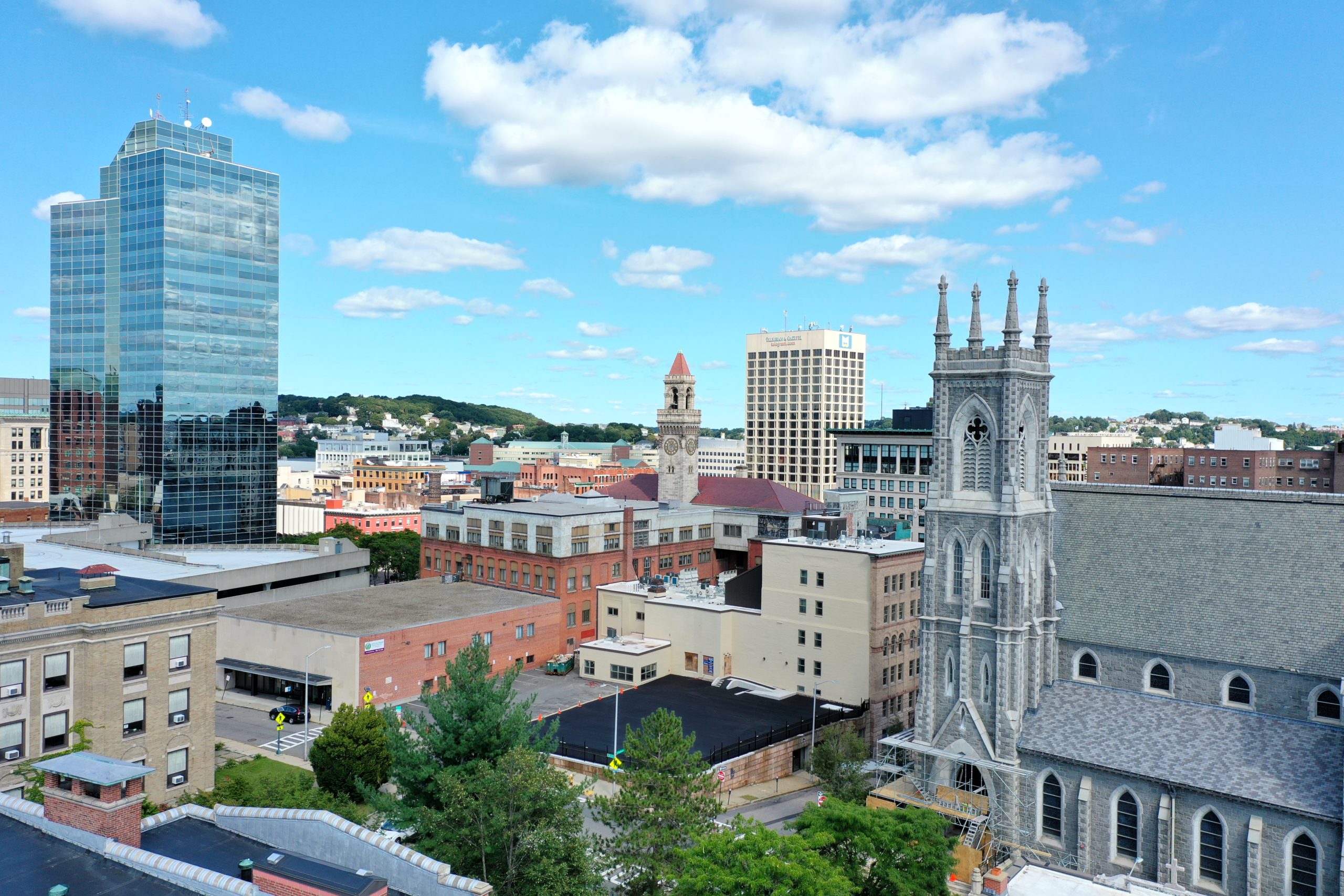
\n
\n
\nA number of roads such as Lancaster Street\, also known as the West Side Artery\, were built in the 1950s as part of a growing movement in urban planning at the time to serve car access. This created virtual concrete canyons dividing various parts of the city. In particular\, the Crown Hill\, lower Chandler\, Pleasant Street\, Elm Park\, and Highland Street neighborhoods were effectively cut off from downtown. The Salisbury Cultural District and downtown were also impacted by the addition of streets such as Lancaster\, Harvard\, and Irving.
\n \;
\nTo address these past planning mistakes and encourage pedestrian connections\, add more community greenspaces\, and create housing density through infill development on excess surface parking lots in this area\, the Chamber has put together an urban planning concept paper for residents\, business and property owners\, and city officials to consider as future economic development and transportation planning priorities are considered.
LOCATION:Top Floor of the Glass Tower at 446 Main Street 446 Main Street\, Worcester\, MA\, 01608 PARKING AT: 40 Pleasant St Garage\, Worcester\, MA
UID:e.2083.17257
SEQUENCE:3
DTSTAMP:20260420T090026Z
URL:https://business.cmschamber.org/events/details/business-government-forum-planning-concepts-to-build-pedestrian-connections-and-housing-density-17257
END:VEVENT
END:VCALENDAR